$375.00 CAD
| /
Below map, info from book that it was inserted into.
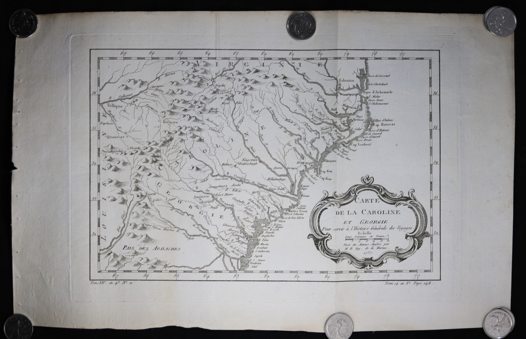
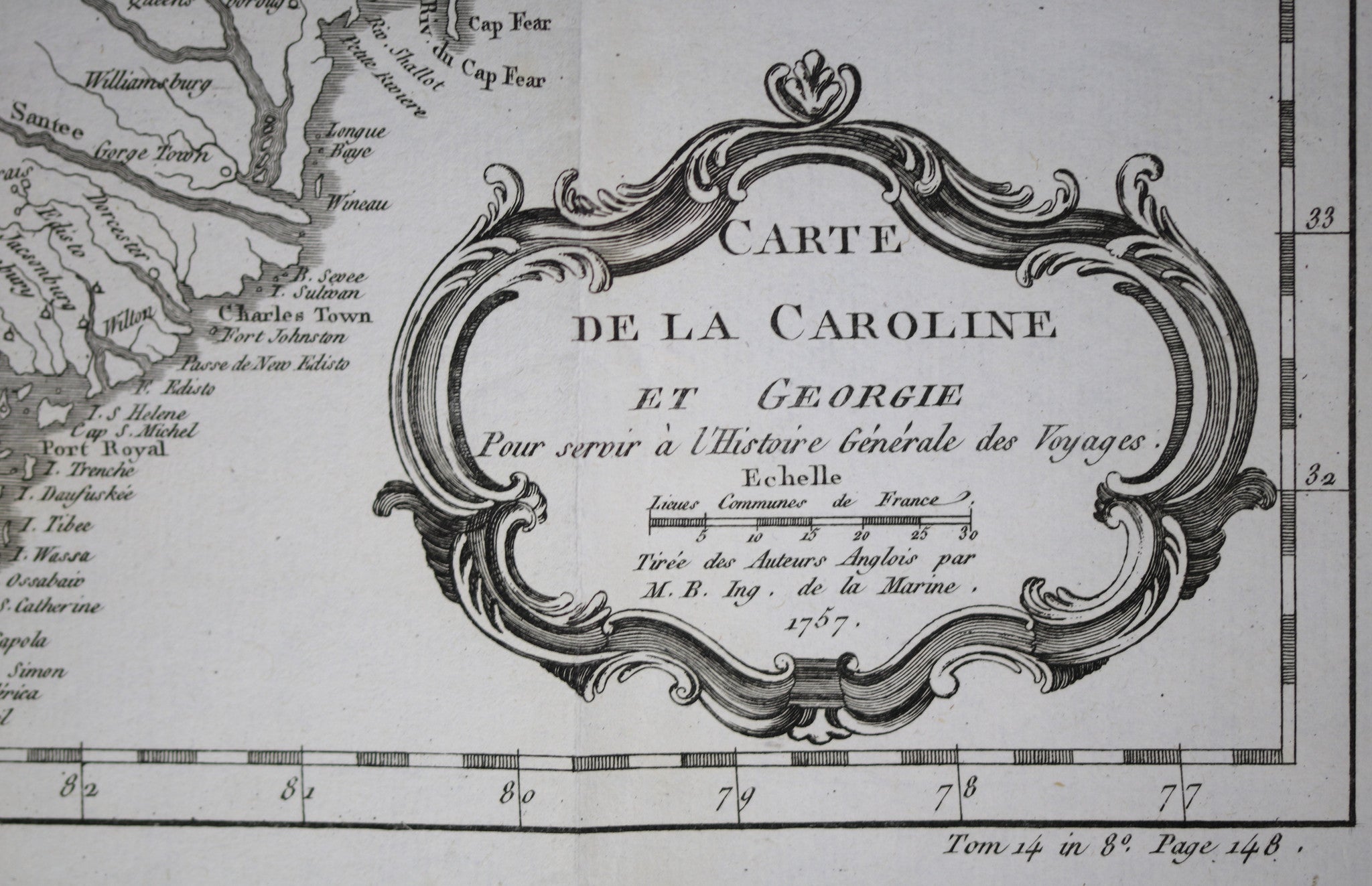
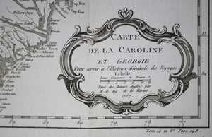
(LL) Tom XIV in 4o. No. 11 (LR) Tome 14 in 8o Page 148
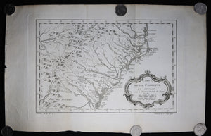
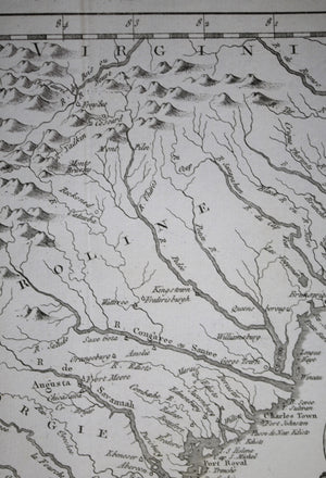
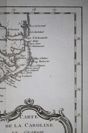
Map by Jacques Bellin, famous cartographer, done for Abbé Prevost's Histoire Générale des Voyages.
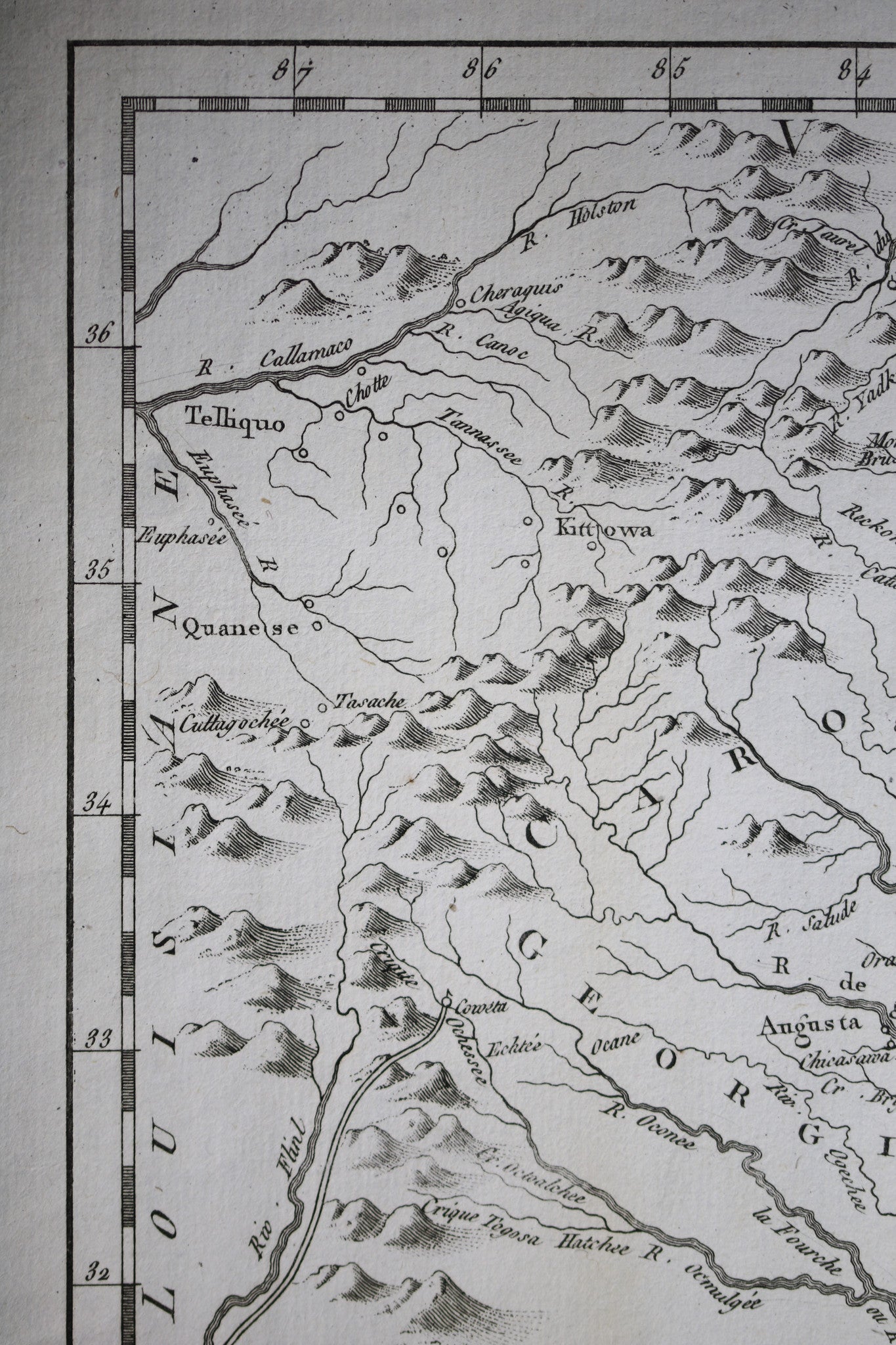
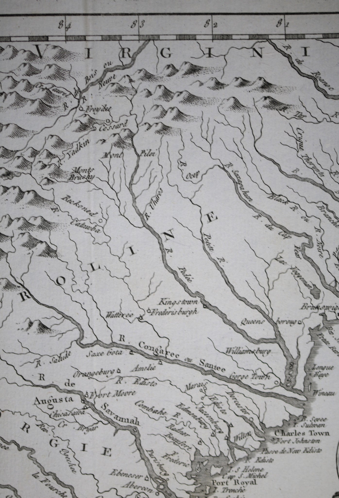
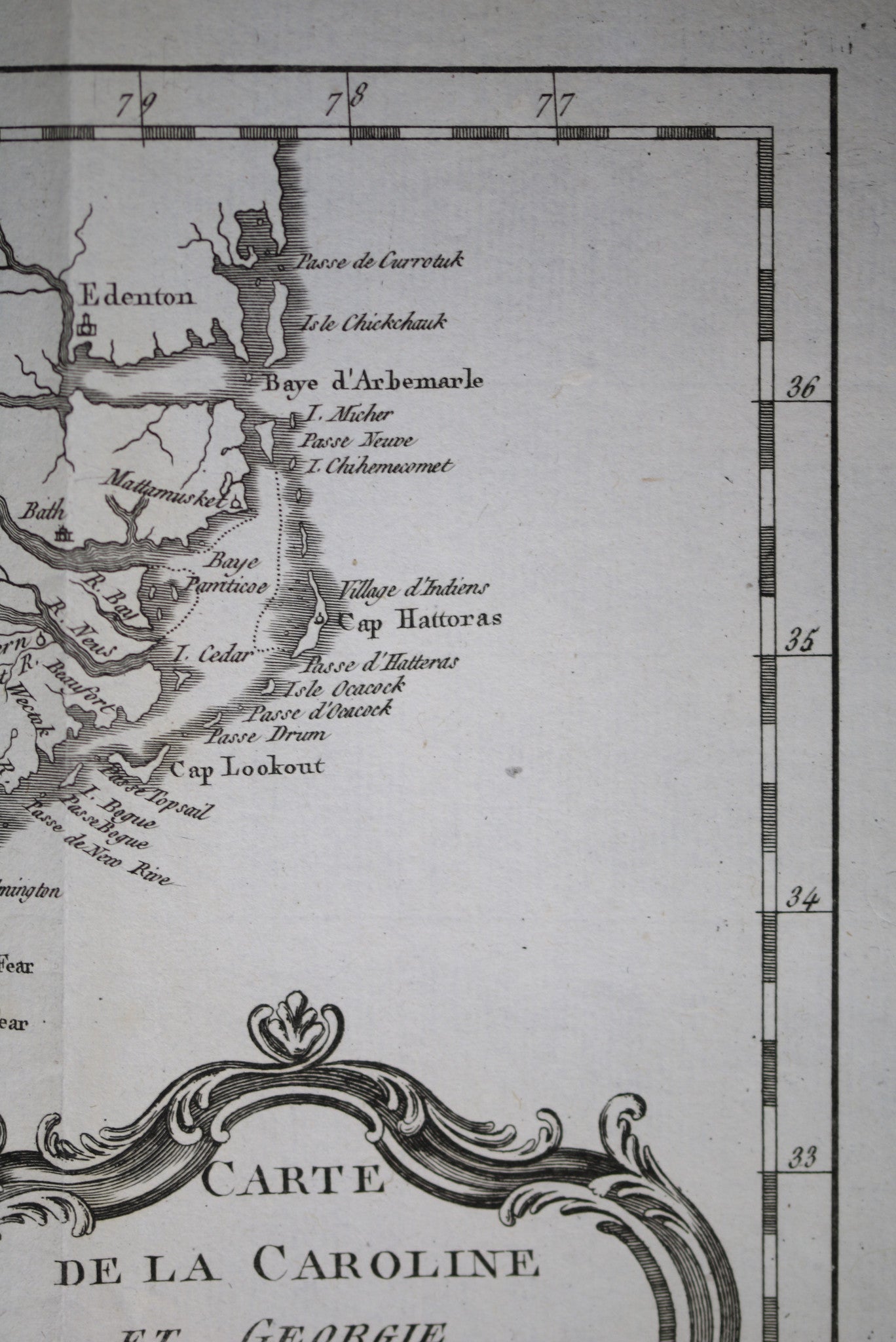
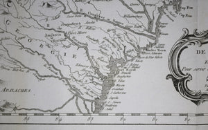
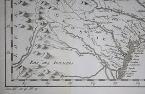
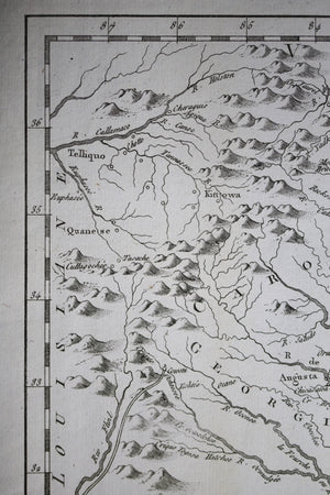
Georgia, Carolina, Louisiana, Virginia.
Interesting details in the Map:
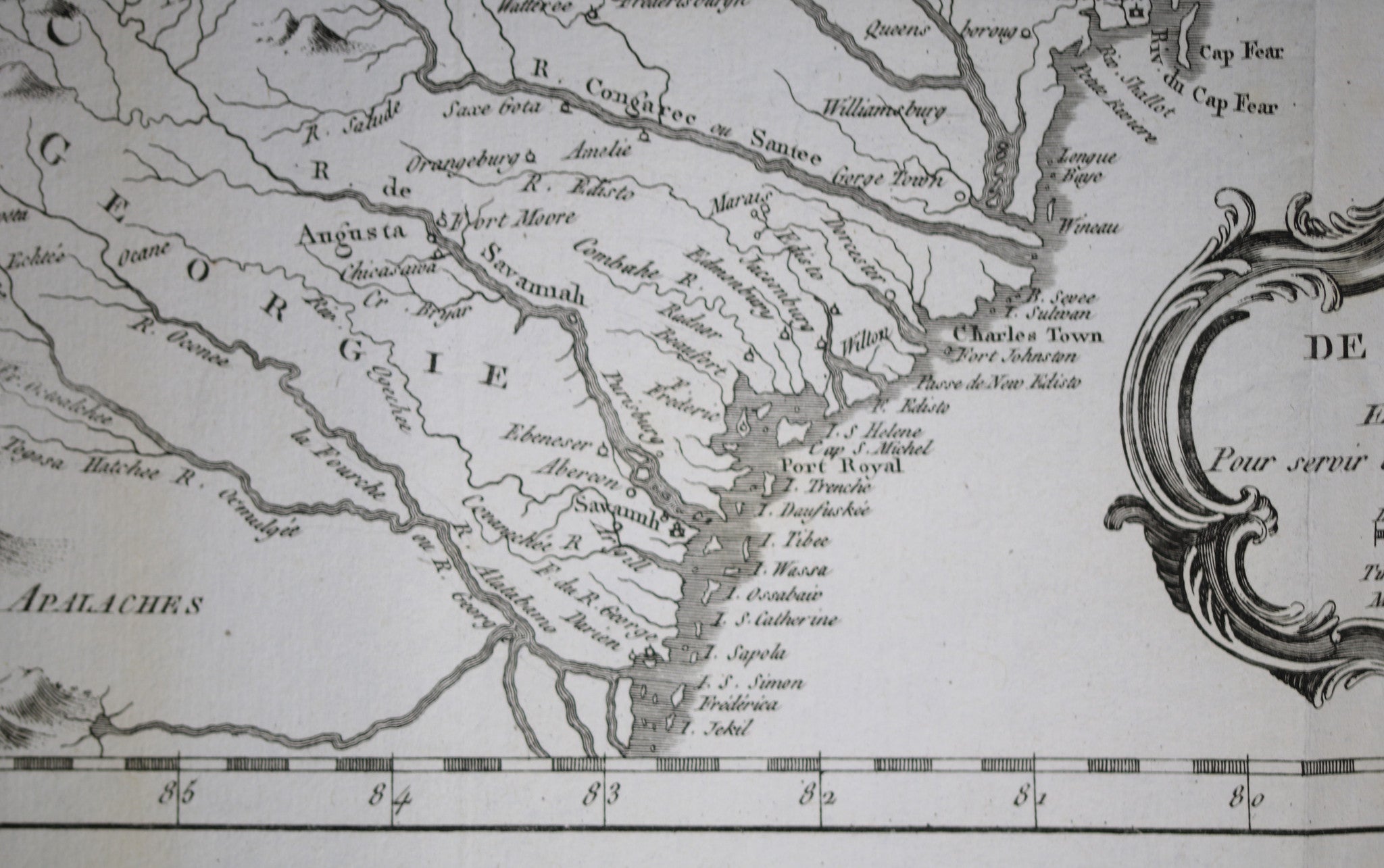
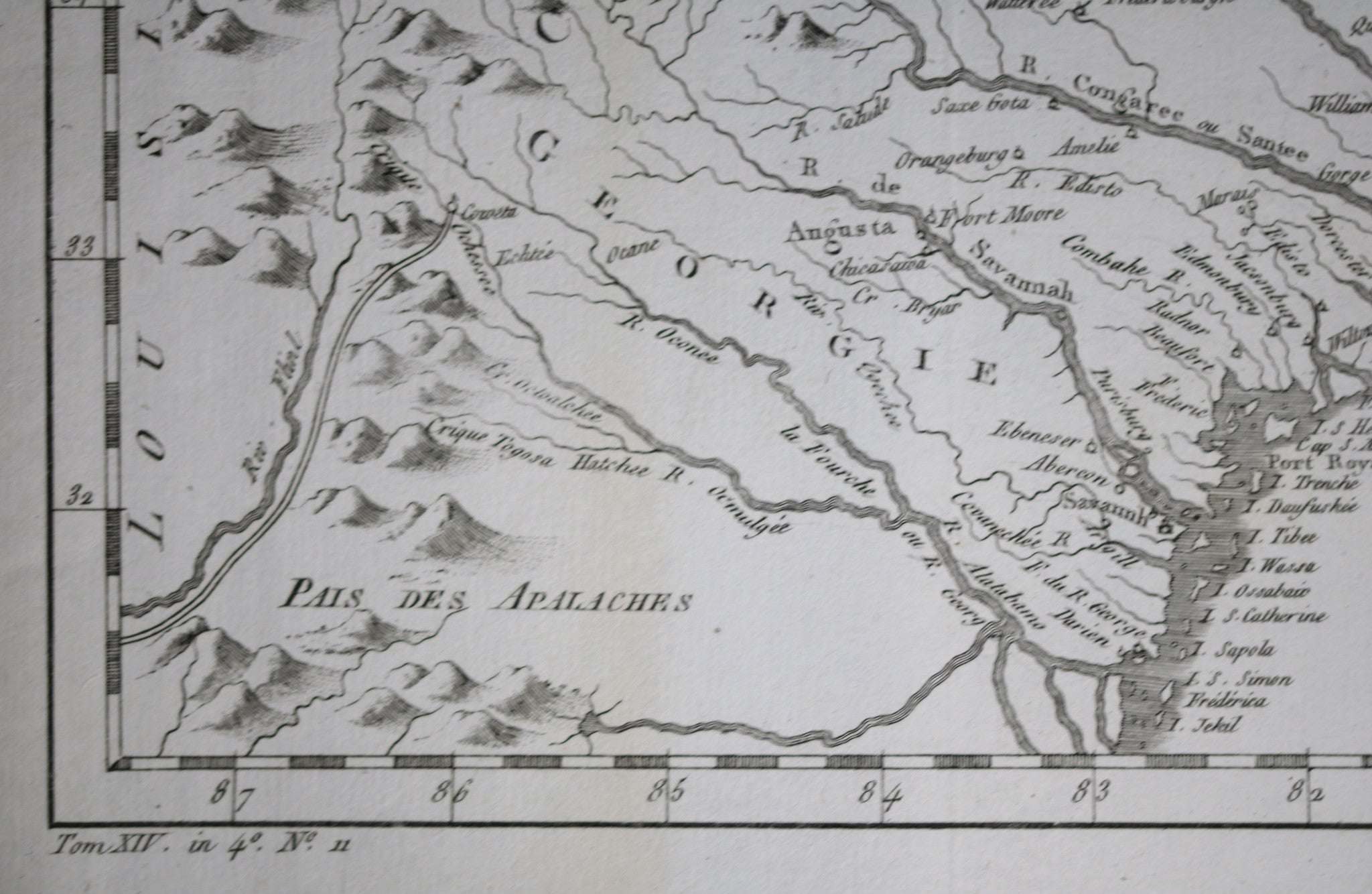
It covers modern day North Carolina, South Carolina and Georgia, and parts of Virginia and eastern Tennessee, extending from just north of the Albemarle Sound south to Jekyll Island in Georgia and inland as far as the Appalachians and beyond. Important early cities and towns are depicted, including Savannah, Georgetown, Charles Town, Augusta, Edenton, etc. are identified.
Map image measures 7 1/4 x 11 inches / 28 x 18.5 cm.
Two vertical folds, as issued. Some light yellowing along edges, one light vertical band of yellowing running up through "GE" of "GEORGIA"
Will ship rolled inside tube.
Jacques Nicolas Bellin (1703 – 21 March 1772) was a French hydrographer, geographer, and member of the French intellectual group called the philosophes.
Bellin was born in Paris. He was hydrographer of France's hydrographic office, member of the Académie de Marine and of the Royal Society of London. Over a 50-year career, he produced a large number of maps of particular interest to the Ministère de la Marine. His maps of Canada and of French territories in North America (New France, Acadia, Louisiana) are particularly valuable. He died at Versailles.
Bellin contributed a number of maps to 15-vol. Histoire Generale des Voyages of Antoine François Prévost or simply known l'Abbe Prevost.
WIKIPEDIA