
$250.00 CAD
| /
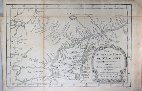
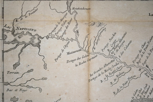
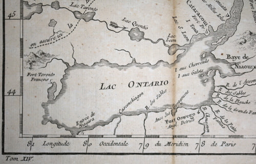
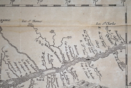
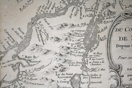
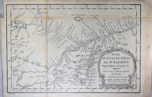
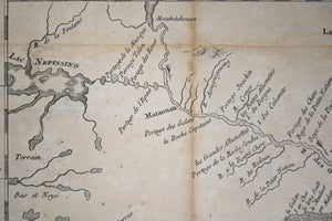
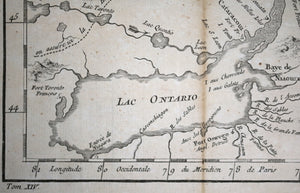
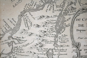
Map of the St. Lawrence river from Quebec City to the west end of Lake Ontario. Also shows the area around Lake Champlain, and goes north along Ottawa River to Lake Nipissing (North Bay Ontario).
This map gives a snapshot of Canada as the Seven Years war was about to begin, which would end in 1763 with Canada becoming an English Colony.
Created by Jacques Bellin, famous cartographer, and done for Abbé Prevost's work Histoire Générale des Voyages.
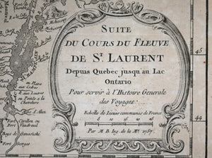
Inside decorative cartouche:
Below map, book volume # that it was inserted into, and map #:
Tom XIV No. 17
Interesting details in the Map:
Folded as issued, to fit into book: 2 vertical folds, one horizontal.Foxing along folds and right edge.
8 ⅛” x 12 ½” // 21 x 32 cm.
Jacques Nicolas Bellin (1703 – 21 March 1772) was a French hydrographer, geographer, and member of the French intellectual group called the philosophes.
Bellin was born in Paris. He was hydrographer of France's hydrographic office, member of the Académie de Marine and of the Royal Society of London. Over a 50-year career, he produced a large number of maps of particular interest to the Ministère de la Marine. His maps of Canada and of French territories in North America (New France, Acadia, Louisiana) are particularly valuable. He died at Versailles.
Bellin contributed a number of maps to 15-vol. Histoire Generale des Voyages of Antoine François Prévost or simply known l'Abbe Prevost.
WIKIPEDIA