
$125.00 CAD
| /
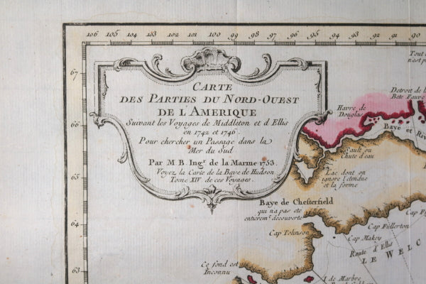
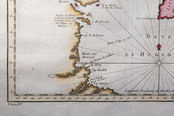
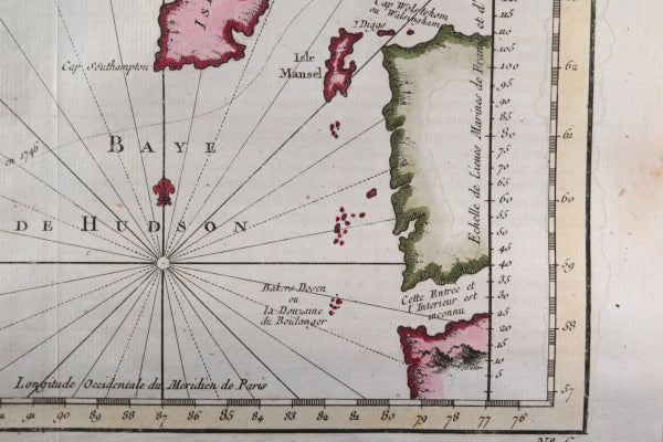
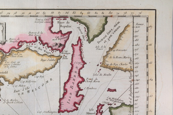
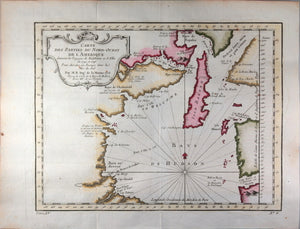
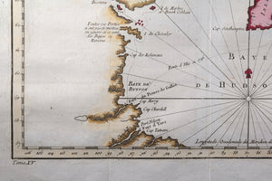
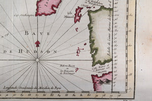
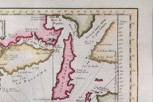
Hand-coloured map of the Hudson Bay area of Northern Canada. Shows Fort Prince of Wales and Fort York, the Ottawa Islands (here the Bakers Dozen), the track of Henry Ellis in 1746, Repulse Bay, Buttons Bay and more. Middleton explored Wager Inlet, Repulse Bay and the northern part of Roes Welcome in search of a Northwest Passage via Hudson Bay in 1746.
One waterway upper right labeled ‘passage way with no name and little knowledge’
Created by Jacques Bellin, famous cartographer, and done for Abbé Prevost's work Histoire Générale des Voyages.
Inside decorative cartouche:
Below map, book volume # that it was inserted into, and map #:
Tom XV No. 6
Copper-plate engraving.
Folds as issued, to fit into book: vertical and horizontal folds. A few rust spots. Toning left and top borders. Light browning area right margin.
Map paper is rounded, was stored in tube.
25.5 x 32 cm.
Jacques Nicolas Bellin (1703 – 21 March 1772) was a French hydrographer, geographer, and member of the French intellectual group called the philosophes.
Bellin was born in Paris. He was hydrographer of France's hydrographic office, member of the Académie de Marine and of the Royal Society of London. Over a 50-year career, he produced a large number of maps of particular interest to the Ministère de la Marine. His maps of Canada and of French territories in North America (New France, Acadia, Louisiana) are particularly valuable. He died at Versailles.
Bellin contributed a number of maps to 15-vol. Histoire Generale des Voyages of Antoine François Prévost or simply known l'Abbe Prevost.
WIKIPEDIA